


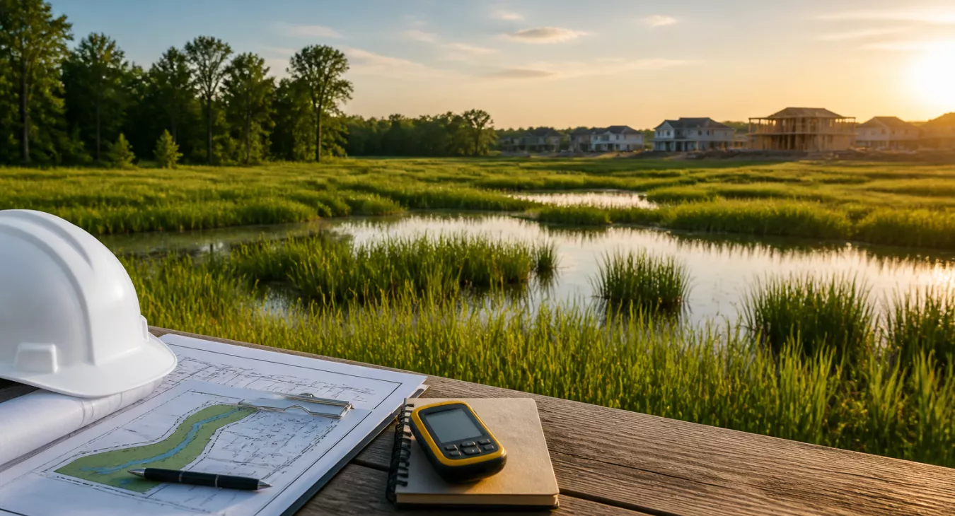
Learn the wetland delineation process timeline to avoid costly delays on your land investment. Expert guide for developers and investors.
Table of Contents
- what's Wetland Delineation?
- The Three-Parameter Method: How Wetlands Are Identified
- Step-by-Step Wetland Delineation Process
- When Is a Wetland Delineation Required?
- Timeline and Duration: What to Realistically Expect
- Cost Considerations
- What Happens After Delineation: Permits and Mitigation
- Regional Variations: Southeast-Specific Considerations
- Hiring a Wetland Delineation Professional
- Common Mistakes and How to Avoid Them
- Conclusion: Delineation as a Risk Management Tool
- Frequently Asked Questions
Finding wetlands on a piece of land you're targeting? That's not necessarily a deal-killer. But pretending they don't exist? That'll destroy your project. Wetland delineation is the formal process that pins down exactly where regulated wetlands start and stop on your property. And here's what matters: understanding the wetland delineation process timeline before you close can literally be the difference between a profitable exit and getting stuck in regulatory hell. You're looking at raw acreage in Georgia. Maybe you're planning a residential subdivision in the Carolinas. Either way, you need to know what delineation actually involves, how many weeks or months it'll take, and what regulatory hoops come after. It's not optional due diligence — it's the foundation of any serious land deal.
Back to topwhat's Wetland Delineation?
Definition and Purpose
A qualified environmental professional walks your site, collects soil samples, documents plant communities, and maps the exact boundaries between wetland and upland. That's wetland delineation — a field-based scientific investigation that produces a defensible boundary line. And that line? It directly impacts your development costs, buildable square footage, and financing feasibility. The stakes are real.
Why Wetlands Are Protected
Section 404 of the Clean Water Act is the federal hammer here. The U.S. Army Corps of Engineers (USACE) and EPA administer it jointly. Wetlands deliver tangible ecosystem services — flood attenuation, water quality filtration, groundwater recharge, and habitat provision — which is why the government treats them like irreplaceable assets.
Filling or draining wetlands without a permit? You're looking at serious civil and criminal penalties. But here's where it gets messy: what qualifies as a federally regulated wetland is still in flux. The Supreme Court's 2023 Sackett v. EPA decision introduced a "continuous surface connection" standard, and the EPA/Army rulemaking proposed in November 2025 hasn't been finalized yet. This matters less than you'd think if you're investing in California, Washington, Minnesota, Wisconsin, Virginia, New Jersey, or New York — those states have their own wetland regulations that operate independently of federal jurisdiction. Your move: talk to a local environmental attorney or consultant before you commit capital. The regulatory landscape varies dramatically by state.
Common Misconceptions About Wetlands
Here's the most expensive mistake land investors make: assuming wetlands look wet. They don't. Many federally regulated wetlands sit dry at the surface for months at a time. Seasonal saturation just below the soil surface — detectable only by trained professionals examining soil morphology and plant indicators — is enough to trigger full regulatory protection. That invisible water table can crush your deal economics if you don't catch it early. Need a practical pre-purchase screening? Our guide on how to identify wetlands on property walks you through reconnaissance techniques that flag problems before you spend serious money on formal delineation.
Back to topThe Three-Parameter Method: How Wetlands Are Identified

Here's what you need to know: the federal standard for wetland identification traces back to the 1987 Corps of Engineers Wetlands Delineation Manual. Ten regional supplements layer on top of that baseline, each one accounting for the specific soil types, plant communities, and hydrology you'll actually encounter on the ground. The bottom line? A site only qualifies as a wetland if it hits all three parameters. Not two. Three.
Hydrophytic Vegetation (Water-Loving Plants)
Plants that thrive in saturated or flooded conditions are hydrophytes, and they're your first clue. The USACE breaks down species into five categories based on how often they show up in wetlands: Obligate Wetland (OBL), Facultative Wetland (FACW), Facultative (FAC), Facultative Upland (FACU), and Upland (UPL). What does that mean for you? A plant community dominated by OBL and FACW species is basically screaming wetland. Look for bald cypress, buttonbush, swamp rose, and various sedges across the Southeast—these are your dead giveaways.
Hydric Soils (Wetland Soils)
Prolonged saturation creates anaerobic (oxygen-depleted) conditions underground, and that's where hydric soils form. Field scientists grab a soil probe or auger and dig for telltale markers: mottling (those streaks of gray, orange, or red), gleying (that distinctive blue-gray color), and sulfidic odors that you'll smell immediately. The Southeast has its own rogues' gallery—Ponzer, Rains, Pelion series, and dozens more documented in USDA's National Hydric Soils List. And here's the thing: coastal plain soils with high organic matter and poor drainage are everywhere in Georgia, South Carolina, and Florida. They're practically a default indicator down there.
Wetland Hydrology (Water Presence and Duration)
This one's a killer to prove, especially when you're dealing with dry periods or drought conditions. Most regional supplements require that water be within 12 inches of the surface for at least 14 consecutive days during the growing season. You're looking for water marks on trees, drift lines, waterlogged soils, visible surface water, oxidized root channels—physical evidence that water was there and stayed. But what happens when you show up during a dry spell or outside the growing season? Experienced consultants step back and lean on secondary indicators and historical data to make the case.
Back to topStep-by-Step Wetland Delineation Process


Step 1: Desktop and Resource Review
You can't just walk onto a property and start digging. A real delineator spends serious hours indoors first, pulling data from the National Wetlands Inventory (NWI) maps, USDA Web Soil Survey, FEMA flood maps, LiDAR topography, historical aerial photography, and state-specific databases. This groundwork creates a solid working hypothesis about where wetlands actually exist — and it saves fieldwork time later. Skip this phase and you'll either miss wetlands entirely or burn cash on unnecessary site visits. That's a quality-control failure that kills deals.
Step 2: Field Investigation
Here's where it gets real. The field visit is everything. According to 2026 data, most sites need one to two days on the ground, with reports turning around in one to three days after. Your field scientist shows up with soil augers, a Munsell soil color chart, region-specific plant IDs, a GPS unit, and flagging tape. They traverse the property methodically, hitting representative locations and documenting every transition from potential wetland to upland.
Step 3: Boundary Flagging and Documentation
Once the data's analyzed, the consultant flags the wetland edge with numbered pins. Every flag gets GPS'd. And here's the critical part: data forms capturing the three-parameter assessment at each plot are filled out in real time. These forms are your evidence. Regulators will scrutinize them hard, so they need to be bulletproof.
Step 4: Surveying and Mapping
The flagged boundary gets surveyed next — either by the environmental consultant using GPS or a licensed surveyor. You'll get a wetland delineation map overlaid on an aerial or site plan. This becomes your ammunition in any permit application. Regulators use it to calculate project impacts and decide what you can actually build.
Step 5: Report Submission and Jurisdictional Determination
Submit the full delineation package — data forms, maps, documentation — to the USACE. They'll issue a Jurisdictional Determination (JD) confirming whether those features are Waters of the U.S. under current law. An Approved Jurisdictional Determination (AJD) is your golden ticket — the Corps' formal written blessing. Per 33 CFR 331.2 and USACE guidance, an AJD stays valid for five years. That's huge if you're holding the property or planning to develop within that window — lock in certainty before conditions shift.
Back to topWhen Is a Wetland Delineation Required?
Ground disturbance, filling, grading, or construction near potential wetlands? You're probably triggering a delineation requirement. We're talking residential and commercial development, road construction, utility installation, stormwater management infrastructure, and certain ag activities. And here's the critical part: you need this done before you close on the land—not after you've already written the check. Even during due diligence, don't wait. Skip this step and you're looking at project redesigns, permit denials, or worse—federal enforcement actions hitting your deal when you least expect it. Want to understand how environmental constraints fit into the broader entitlement picture? Check out our breakdown of the land use entitlement process.
Back to topTimeline and Duration: What to Realistically Expect
Wetland delineation timelines swing wildly. Site complexity, season, and your regulatory pathway all matter. Here's what you're actually looking at:
| Phase | Typical Duration | Key Variables |
|---|---|---|
| Desktop Review & Research | 1–3 days | Data availability, parcel size, existing maps |
| Field Investigation | 1–2 days on site | Acreage, access, vegetation density, season |
| Report Preparation & Delivery | 1–3 days post-visit | Complexity, consultant workload |
| Total: Start to Finished Report | 2–4 weeks (typical) | Scheduling, seasonal access, site conditions |
| USACE PCN Review (Nationwide Permit) | 55 days average (FY 2024) | Corps district workload, project complexity |
| USACE Individual Permit (Section 404) | 253 days average (FY 2024) | Public notice period, agency coordination, mitigation |
| NWP "Deemed Authorized" Window | 45 days after complete PCN | Complete PCN submission required |
The delineation report? That's the quick part. A few weeks, tops.
But the regulatory review—especially if you need an Individual Permit—that's where deals stall. We're talking 253 days average for Section 404 permits in FY 2024. That's eight and a half months. You need to account for that in your acquisition and construction timeline, or you're leaving money on the table with carrying costs and delayed exit strategies.

Seasonal Constraints
March through October—that's your sweet spot in the Southeast if you're serious about a delineation that'll hold up. Vegetation's visible. Hydrological indicators are obvious. Winter work? Technically possible, but you're leaning harder on secondary indicators and opening yourself up to regulatory pushback.
And here's the thing: if your deal timeline allows, schedule field work during growing season. Don't fight the system.
AJD Validity
An Approved Jurisdictional Determination lasts five years. For investors holding property for future development or resale, that's a real planning window. You've got documented environmental clarity—the kind that gives future buyers or lenders confidence they're not walking into a wetland nightmare. That's an asset worth protecting.
Back to topCost Considerations
Here's the thing: you can't separate cost from timeline. Budget constraints push most investors toward cutting corners on scope, and that's when deals fall apart. Small parcels under five acres typically cost $2,500–$5,000 for a full delineation. But if you're dealing with a complex or large site? You're looking at $15,000–$20,000 or more.
Wetland consultants charge $115–$190 per hour plus travel in 2026. Add in field work and report prep. You're spending roughly $500–$1,500 per acre total. And that's where most investors get surprised.
Want the full picture? Check out our deep dive on wetlands delineation cost for land investors and our follow-up on wetland delineation report cost and investment impact.
Back to topWhat Happens After Delineation: Permits and Mitigation
Permit Pathways
You've got three ways forward once you know what wetlands are on your property. Avoid them in your design. Minimize impacts and grab a Nationwide Permit (NWP) for small disturbances. Or go after an Individual Permit if you're hitting the site harder. The 2026 Nationwide Permits kicked in on March 15, 2026, replacing the old set that expired the day before. Here's where it matters for residential: NWP 29 lets you impact up to one-half acre of permanent Waters of the U.S. loss across your whole subdivision. Blow past that half-acre and you're stuck in Individual Permit hell — expect 253 days minimum just to get approval.
Mitigation Requirements
Can't avoid the wetlands? Then you're buying your way out through compensatory mitigation. That means replacing whatever wetland functions you kill off. Stream bed loss over 0.03 acres on PCN projects triggers it under General Condition 23 — and yes, that's still in the 2026 reissuance. You've got three paths: buy credits from a wetland mitigation bank, write a check into an in-lieu fee program, or do on-site permittee-responsible mitigation (rare for development). Mitigation banking wins every time — fastest approval, fewest headaches. And here's the critical part: these costs aren't trivial. Bake them into your pro forma before you even make an offer. Environmental constraints hit raw land valuations hard. Check out our guide to raw land valuation methods to see how environmental issues reshape what you should actually pay.
Back to topRegional Variations: Southeast-Specific Considerations

The Southeast's wetland environments are brutal to navigate. Coastal plain geomorphology, high rainfall, and flat topography create extensive systems that don't match the obvious "swamp" picture most investors expect. You'll find subtle wetland delineations that can kill a deal if you miss them.
- Coastal vs. Inland: Tidal wetlands near the coast hit you with additional state and federal protections — the Coastal Zone Management Act kicks in, and states like Georgia, South Carolina, North Carolina, and Florida layer on their own coastal programs. This means more agency coordination beyond just USACE review.
- State-Specific Regulations: Florida's doing its own thing through Water Management Districts under the Environmental Resource Permit program, usually alongside federal review. North Carolina requires a 401 Water Quality Certification attached to most federal 404 permits. Georgia and South Carolina? They add their own 401 layers too. Don't assume one state's process works for another — these run parallel to federal review and they'll often control your timeline.
- Soil Variability: The coastal plain shows hydric soil indicators across huge, flat areas that look bone-dry on the surface. Spodosols and ultisols dominate the region. Without regional soil expertise, you'll misread these constantly.
- Dry-Appearing Wetlands: Longleaf pine flatwoods, pocosins, and Carolina bays get flagged as uplands by consultants who don't know the region. The surface reads dry. But dig deeper — the critical depth is saturated during growing season. That's a wetland, and it'll cost you.
Regional expertise isn't optional here. It's the difference between a defensible delineation and regulatory pushback that tanks your project timeline. Hire a consultant who's worked Mid-Atlantic soils and vegetation lists on a South Carolina flatwoods site? That's a liability waiting to happen.
Back to topHiring a Wetland Delineation Professional

USACE training matters. So does familiarity with your regional supplement and — this is non-negotiable — a solid track record of approved delineations in your specific USACE district. You want proof they've gotten projects green-lit before, not just completed them.
What credentials should you actually care about? Look for Certified Professional in Erosion and Sediment Control (CPESC), Professional Wetland Scientist (PWS) through the Society of Wetland Scientists, or an environmental science degree with documented Corps-approved delineation experience. The combo matters more than any single certification.
References are everything here. Ask for projects in your county or district specifically, not generic state-level work. Someone who's done fifty delineations statewide but none in your USACE district is useless to you.
And here's where risk management kicks in: if wetland issues could tank your deal economics, get your land purchase agreement reviewed by a qualified attorney who actually understands environmental contingencies. Don't skip this step. The difference between a $50K remediation cost and a $500K one depends on how your contract's written.
Running a subdivision play on this land? Then you need to understand the legal process for subdividing land alongside your environmental constraints. These issues intersect in ways that'll kill your timeline and ARV if you're not prepared.
Back to topCommon Mistakes and How to Avoid Them
- Ordering delineation after contract execution with no contingency: Here's the hard truth: environmental due diligence needs its own contingency clause. Discoveries post-close? They'll drain your profit margins faster than you can imagine.
- Relying solely on NWI maps: Don't make this mistake. NWI maps systematically undercount wetlands—they're a starting point, not your finish line. A field delineation is what you actually need.
- Using a non-regional consultant: Your consultant needs to know the regional supplements cold. In the Southeast, this isn't optional.
- Skipping the AJD request: You got the delineation report. Great. But did you actually submit it for Corps concurrence? Without an AJD, you've got nothing but a consultant's opinion—and that won't protect you. An AJD is what gives you five years of documented regulatory protection.
- Ignoring state-level triggers: Federal 404 compliance is just the floor. A project that clears federal jurisdiction can still get tangled up in state wetland permits, especially if you're working in a state with independent programs. Don't assume federal approval covers everything.
Conclusion: Delineation as a Risk Management Tool
Here's the reality: wetland delineation takes time. Your desktop review through USACE jurisdictional determination? That's typically two to four weeks for the report. But throw an Individual Permit into the mix and you're looking at nine months or longer. And that's where most investors miss the play.
Think about it differently. A $5,000 delineation on a property you're evaluating can save you from overpaying for a site that's actually unbuildable due to wetland constraints. That's not a regulatory checkbox — that's intelligence. You find out front whether you've got a solid development parcel or a preservation asset before you tie up your capital.
The delineation report stays valid for five years. That documented boundary supports your financing, your entitlement applications, and eventually your exit. You want that locked down early.
Here's how to do it right: hire professionals who actually know your region, not someone phoning it in from across the country. Build your project timeline around the regulatory phases instead of trying to force permits into your construction schedule. Integrate delineation early. That's it.
Back to topFrequently Asked Questions
How long does a wetland delineation take from start to finished report?
Most parcels move from initial desktop review to final report in two to four weeks (as of 2026). The field work itself? One to two days on site. Then you're waiting another one to three days for the written report. Scheduling, seasonal conditions, and site access drive most delays beyond that window.
How long is a wetland delineation valid?
An Approved Jurisdictional Determination (AJD) from USACE holds for five years under 33 CFR 331.2. After that, site conditions shift and you'll need re-verification. A delineation report without a Corps-issued AJD has no formal expiration date, but it's also less bulletproof as supporting documentation.
What's the USACE permit review timeline after a delineation?
Depends entirely on which permit bucket you fall into. Nationwide Permit projects that need Pre-Construction Notification? USACE averaged 55 days in FY 2024. You get a regulatory "deemed authorized" window of 45 days after submitting a complete PCN. Individual Permits (Section 404)? Those ran 253 days in FY 2024. Build these timelines into your acquisition underwriting.
Can I use NWI maps instead of hiring a delineator?
No. Don't even think about it. The National Wetlands Inventory is a preliminary screening tool with zero regulatory standing. It systematically undercounts wetlands—especially in the Southeast—and won't hold up in any permitting discussion. You need a formal field delineation by a qualified professional submitted to USACE for an Approved Jurisdictional Determination. That's the only legally defensible boundary.
What triggers the need for an Individual Permit rather than a Nationwide Permit?
Several factors bump you from the Nationwide Permit pathway into the Individual Permit grind. For residential developments under NWP 29, if permanent wetland impact hits one-half acre in aggregate across the entire subdivision, you're moving to Individual Permit (as of the 2026 NWP reissuance). And Corps or resource agency concerns about significant impacts, projects in sensitive areas, or failure to meet NWP terms and conditions will force the same outcome.
Back to top